W.Va. in state of preparedness due to possible winter storm, WVDOT ready to clear roads
By RealWV staff
On Thursday, January 2, Gov. Jim Justice announced a state of preparedness for all 55 counties in anticipation of winter weather and dangerous wind chills.
According to Jason Christian of Blue Weather and Real WV, “we have a mess on our hands especially for travel.”
“Some of you will start as snow then freezing rain and sleet for hours then change back to snow by Monday,” Christian wrote in a social media post on Thursday. “Keep in mind snow totals on the north side of the storm are NOT set in stone yet.”
The National Weather Service has issued a Winter storm watch from Sunday morning until Monday evening for western Greenbrier County, and has estimated that between 3-6 inches of snow will fall with ice accumulations up to four tenths of an inch. In eastern Greenbrier County, the NWS has issued a Winter storm watch with estimated snowfall totals of 1-3 inches and ice accumulations up to four tenths of an inch.
WVDOT urges caution during upcoming winter storm as crews prepare to fight ice and snow
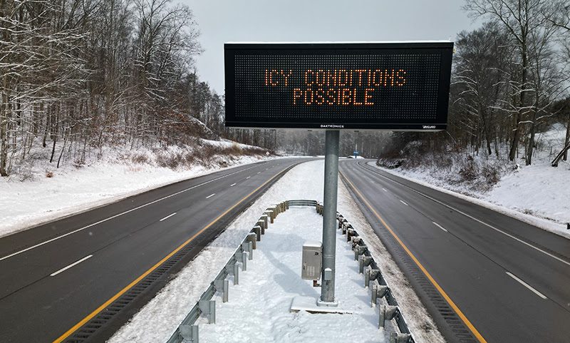
The West Virginia Department of Transportation (WVDOT) is urging drivers to slow down and be extra cautious when a significant winter storm is expected to impact the state starting late Sunday, January 5, 2025, and lasting through Monday morning, January 6, 2025.
Snow began early on the morning of Friday, January 3, 2025 in most of the state, but tapered off and stopped on Friday morning. Clear skies were expected over most of West Virginia on Saturday, January 4, with snow expected to return to the Mountain State on Sunday, January 5, 2025. Accumulations of four to 12 inches were expected in different parts of the state.
Joe Pack, P.E., WVDOT Chief Engineer of Operations, said the state has approximately 1,000 snowplows mobilized and on the roads to fight snow and ice. Snowplows will operate 24 hours a day, seven days a week, until the weather event is over.
“We prepare for an inch of snow the same way we prepare for 12,” Pack said.
Pack said the WVDOT started the year with a stockpile of approximately 231,000 tons of salt statewide, and will replenish the supply as necessary. The amount of salt on hand is based on how much salt the agency has used each year over the past 10 years.
Snowfall on Thursday and Friday was not heavy, but clearing efforts were complicated by an expected temperature drop.
“It’s the cold temperatures that get you,” Gaskins said. “We don’t have a lot of snow to push off the road, but we’re constantly fighting the ice.”
Pack said the safest choice during snowstorms is to simply stay home. WVDOT recommends that all non-essential travel be postponed to allow road crews to clear and treat highways without interference. Fewer vehicles on the road will reduce the risk of accidents and help speed up snow removal efforts. For those who must travel, WVDOT encourages drivers to allow extra time to reach their destinations. Snow and ice can create hazardous conditions that lead to slower traffic and increased risk of collisions.
What Drivers Can Do To Help Plow Workers:
- Give Snowplows Space. Stay at least 100 feet behind snowplows, and do not try to pass them unless absolutely necessary.
- Slow Down. Even when you see snowplows, reduce your speed and allow extra time to reach your destination.
- Avoid Sudden Stops or Maneuvers. Plows may be spreading salt or brine, and sudden changes in direction or speed can make the roadway more hazardous for everyone.
- Be Mindful of Multiple Plows. Plows often travel in groups to treat large areas at once, so keep a safe distance from all plows in the convoy.
Each district also has a stockpile of salt to use as needed throughout the winter. WVDOT crews will be mobilized around the clock to treat major routes and clear snow. High-priority areas, including interstates and primary roads, will be cleared first, while secondary and mountain roads will be addressed as conditions allow. Some areas may see road closures or restrictions due to hazardous conditions. The WVDOT will evaluate road conditions throughout the storm and provide updates on any closures or detours as necessary. Drivers are encouraged to monitor road conditions closely and plan their travels carefully.
The storm is expected to affect the region throughout Monday, January 6, 2025, with the worst conditions likely to occur between 6 a.m. and 3 p.m. The storm will begin to taper off by the evening hours, but travel disruptions may persist into Tuesday, January 7, 2025. The WVDOT will continue to monitor conditions and adapt response efforts as needed.
West Virginia Department of Health warns of serious health risks from freezing temperatures
“It’s essential that all West Virginians take the necessary precautions to stay safe during this period of freezing temperatures,” said Dr. Sherri Young, DO, MBA, FAAFP, Secretary of the Department of Health. “Temperatures this low, combined with wind chill, can cause frostbite in less than 30 minutes. Protecting yourself, your family, and even pets is vital during these extreme conditions.”
Residents without adequate heating sources are encouraged to contact their local Emergency Manager or health department for information on the nearest shelter or warming station. “Stay safe, stay warm, and check on your neighbors during this extreme weather event,” added Dr. Young.
To assist residents, communities have opened warming shelters. Local emergency managers and community groups are working to report open shelters to West Virginia 211. Those in need of assistance should visit wv211.org or call 211 for information on nearby shelters and resources.